 The Department of Agriculture’s information system based on satellite data and ground observations is helping the Philippines monitor rice production and prepare for and mitigate the effects of disasters to rice areas such as typhoons and El Niño.
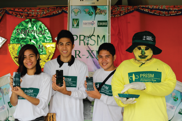
The Philippine Rice Information System (PRISM) project will present key achievements and activities on its first annual executive meeting, 31 March. High-level officials including Senator Cynthia Villar, Agriculture Secretary Proceso Alcala, DA undersecretaries, and other stakeholders are expected to attend the event.
Since 2014, this monitoring and information system has been generating timely seasonal data on rice areas and yield, and assessment of crop health and damage in the event of typhoons, flood, or drought.
Rice mapping and monitoring
“PRISM sparks innovation in the field of Philippine Agricultural Information Systems,” said Jovino De Dios, Information Systems division head at PhilRice.
“It integrates three cutting edge technologies into one usable system to serve rice stakeholders. The space technology gives us updated maps, the information technology delivers information at the right time and entity, and the agricultural technology uses mobile field gadgets to capture data and observations,” De Dios continued.
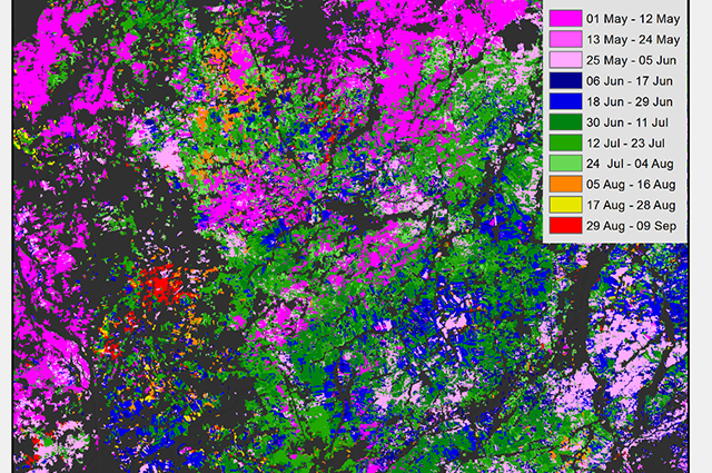
For rice mapping and monitoring, PRISM uses remote sensing, crop modeling, cloud computing, and smart phone-based surveys. Throughout the rice growing season, it uses high-resolution Synthetic Aperture Radar (SAR) imagery.
“SAR imagery can be acquired day or night and even on cloudy days. This makes the technology perfect for monitoring rice growth and assessing damage to rice crops due to floods and typhoons,” said Dr. Alice Laborte, lead of the PRISM project at the International Rice Research Institute (IRRI).
An improved accuracy
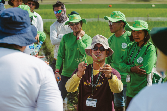
The IRRI official added that rice maps derived from satellite images undergo validation through field surveys. On data gathering, the project enjoins and trains local field technicians from the DA’s regional field offices, local government units, and, in some cases, farmers.
“This activity provides a way for us to assess the accuracy of PRISM products while helping build the technical skills and capacity of our partners. For instance, our rice maps for the 2015 wet season have an overall accuracy of 85% based on 2,223 validation points throughout the country,” Laborte elaborated.
 Crop damage and loss assessment
From the 2014 and 2015 cropping seasons, 443 satellite images across the country were acquired and used in rice area mapping and damage assessment. Some of these images were used to map flood-affected parts of Nueva Ecija where last year’s Typhoon Koppu (Lando) hit. This also helps assess drought-affected areas in Mindanao since last year due to the prolonged El Niño.
“These pieces of information are very useful in improving damage and loss assessments to assist in providing appropriate interventions for rehabilitation and recovery and to improve pre-disaster preparedness,” said Engr. Christopher V. Morales, DA field operations service OIC-director.
Meanwhile, pests and diseases can damage nearly 40% of the rice crops in Mindanao. This information is based on data collected by project partners who use smartphone applications that are useful for gathering and submitting data to a server in real-time.
Recent information on crop health, such as intensities of injuries caused by pests and diseases and cropping practices of farmers, will also be presented on the PRISM meeting.
 Call for policy support
“Being at the forefront of rice R&D, we call on our policymakers to support technological innovations such as PRISM. Advancing information technology can lead to timely and crucial information on which farmers and other stakeholders can base their decisions; surely leading to competitiveness in the rice supply chain,” said Dr. Calixto Protacio, PhilRice’s executive director.
“Given various locations, planting dates, and effects of extreme weather events, we can now have a better, faster, and accurate assessment of rice areas, yield estimates, and forecast through the power of remote sensing,” said Dr. Jimmy Quilang, deputy executive director for research and PRISM project leader at PhilRice.
He added that these valuable information will help our decision-makers to act immediately and implement adjustments and improvement on food security plans.
To be continued by the DA beyond 2017, the project is a pioneering achievement as the Philippines is the first country in Southeast Asia to have such an operational system. Quilang considers this as a “breakthrough in rice history.”
PRISM, one of the seven projects under the Food Staples Sufficiency Program (FSSP), is a collaborative project among IRRI, PhilRice, and the DA. Its development and implementation in the Philippines are funded under the DA’s National Rice Program and managed and monitored by the Bureau of Agricultural Research (BAR).