Municipal Agriculturist of Sta. Cruz, Benedicta R. Tobias (R), evaluates flood damage in her area to document climate-related hazards and their impacts.
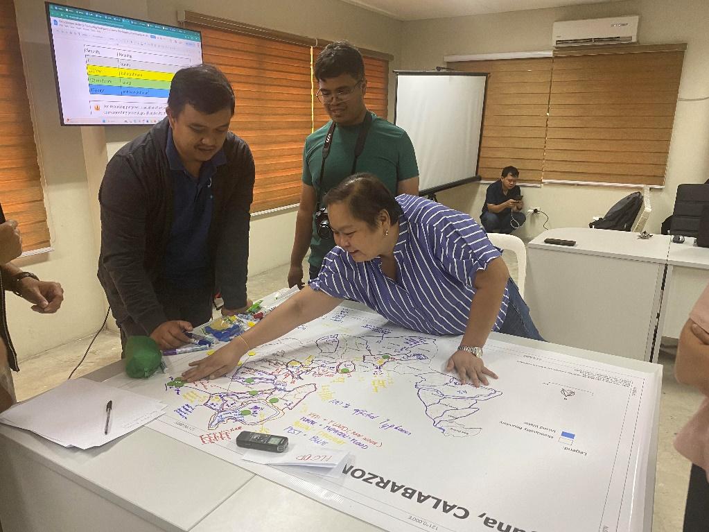
A participatory climate risk-mapping workshop organized by the Climate-Smart Maps for Strengthening Adaptation Plans of Farming Communities (CS Map) project developed by PhilRice and Central Luzon State University (CLSU) was held on April 30 at the Office of the Provincial Veterinarian in Santa Cruz, Laguna. This is to assist local governments and communities by developing provincial maps on climate risks and crop suitability, and creating climate change adaptation and mitigation plans for rice-growing areas.
The project aims to identify and document climate-related hazards, including typhoons, floods, droughts, and pests, and assess their impact and frequency. They also created a seasonal hazard calendar and mapped resources such as irrigation, financial support, and agricultural institutions. The workshop concluded with the validation of satellite-based maps highlighting vulnerable rice areas prone to drought and floods.